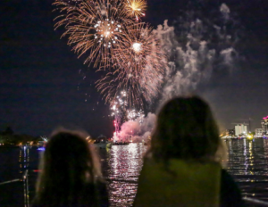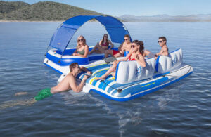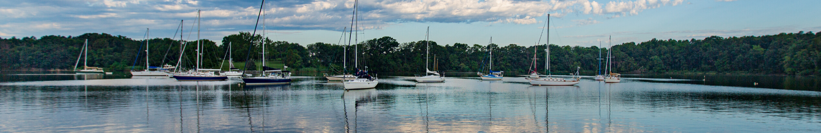
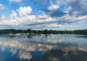
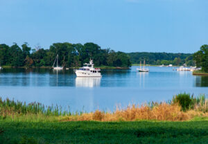
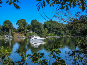
THE CHESAPEAKE BAY’S 11,684 miles of shoreline are packed with great places to drop the anchor, turn off your engine and kick back to enjoy the view. Whether you’re seeking a place to take a refreshing dip in the water, drop a line to catch dinner, hook up with friends or take the dinghy ashore to hike trails or grab provisions, the following 25 Chesapeake Bay anchorages rank among our favorite destinations for a day trip or overnight stay.
MARYLAND
1. Woodland Creek, Sassafras River, MD
Coordinates: 39°21.651’ N 75°55.282’ W
Depth: 4-7 feet
Protection: Slight exposure to north winds
Description: Great Chesapeake Bay Anchorages near the entrance for drafts of 6 to 7 feet; farther south into the cove it’s 4 to 5 feet. Wind protection from all directions. Soft mud and clay for excellent anchor holding in 30 knots or more. It’s a 1.5-mile dinghy ride to nearby marinas, restaurants and marine stores.
2. Sue Creek, Middle River, MD
Coordinates: 39°17.159’ N 76°24.309’ W
Depth: 4-5 feet
Protection: All around
Description: A protected anchorage that can get crowded on weekends. Baltimore Yacht Club fuel dock is at the entrance of the creek, so many boats may be circling and waiting to dock. Depth can be an issue if you draw 4+ feet, especially at low tide. Stay to the north side of the creek after rounding the point past the fuel dock; most boats anchor on the south side for decent depth. Holding is good even though the bottom is very soft.
3. Worton Creek, Eastern Shore, MD
Coordinates: 39°17.629’ N 76°10.247’ W
Depth: 6-8 feet
Protection: Exposed to west winds
Description: Easy in and out but watch out for the crab pots. On weekdays, you’re likely to have the anchorage all to yourself; peaceful with spectacular sunsets. Very little boat traffic. Would not recommend in a west wind as very exposed to that side. Anchor came clean up with little mud.
4. Hart Miller Island, Middle River, MD
Coordinates: 39°15.379’ N 76°22.381’ W
Depth: 8-10 feet
Protection: Exposed to north and northwest winds
Description: Visit this nature area on a man-made spoil island. Access at main beach near the tower that’s manned Thursday-Sunday. You can find bicycle rentals to tour nature loops or walk amidst surprisingly beautiful scenery. The inner loop offers better views. Anchorage can be busy on weekends.
5. Fairlee Creek, Eastern Shore, MD
Coordinates: 39°15.827’ N 76°12.442’ W
Depth: 5-6 feet
Protection: All around
Description: This place changes character from weekends to weekdays. On some weekends, it’s packed with boats. Anchoring in close quarters is not a problem, because it is sheltered from current and wave action. The little tiki bar, Jelly Fish Joels, is right on the beach. On weekdays, it has just a few boats. Absolutely quiet. Take photos of the bald eagles fishing. Yes, it’s tight, but navigating 38-foot catamaran with a 21.5-foot beam is no problem. Stay a little left of center between Shell Point and the northern shore. Little tip: If you come in when there is a slight current, you can see the ripples of the shallow water.
6. Swan Creek, Rock Hall, MD
Coordinates: 39°9.146’ N 76°15.235’ W
Depth: 5-7 feet
Protection: All around
Description: This can be a very popular place on the weekends with lots of boats, but it’s quieter on weekdays. Good holding. A few public dinghy docks. Take the trolley (in season) or a short one-mile walk into Rock Hall for groceries and supplies. Very scenic.
7. Langford Creek, Cacaway Island, Chester River, MD
Coordinates: 39°7.451’ N 76°9.742’ W
Depth: 9-16 feet
Protection: Somewhat exposed to southwest winds
Description: Beautiful Chesapeake Bay anchorage. Good holding in sand and mud. Open enough to catch an evening breeze. Protected by the island if a thunderstorm rolls through. The island is private, and visitors tend to respect that, generally staying below the high tide line in the public land. Lots of places to explore by dinghy. Marine supplies, fuel water and pump out are available at the nearby marina.
8. Corsica River, Centreville, MD
Coordinates: Long: 39°4.836’ N 76°6.534’ W
Depth: 8-9 feet
Protection: Somewhat exposed to west winds
Description: A favorite anchorage for locals with some traffic on the river and boat wakes. Good scenery, quiet river after dark and convenient beaches for the dog’s shore leave. It’s not a problem during the week but can get busy on weekends.
9. Eagle Cove, Magothy River, MD
Coordinates: 39°5.338’ N 76°26.079’ W
Depth: 8-9 feet
Protection: Somewhat exposed to west winds
Description: Great anchorage on the north shore. A large horse farm overlooks the anchorage. It’s usually very quiet and is in a no-wake zone on weekends and holidays. Great scenery and swimming. Throw over a few lines with attached chicken necks, and you’ll usually catch enough crabs for a meal.
10. Dobbins Island, Magothy River, MD
Coordinates: 39°04.791’ N 76°27.767’ W
Depth: 9-10 feet
Protection: Somewhat exposed to north and northeast winds
Description: Popular weekend spot. Plenty of depth 30 feet from the northern side of the island. At low tide, the sand bar to the west is awash and lots of fun for the kids.
11. Dividing Creek, Wye River, MD
Coordinates: 38°53.099’ N 76°9.374’ W
Depth: 7-10 feet
Protection: Somewhat exposed to south winds
Description: All of Wye River is lovely; Dividing Creek is especially so. Easy navigation, with accurate charted depths. With many places to anchor along the river, choose your spot based on predicted wind. The holding is great with an instant set. Beautiful in the fall with colored leaves.
12. Shaw Bay, Wye River, MD
Coordinates: 38° 51.235’ N 76° 11.012’ W
Depth: 12-18 feet
Protection: Exposed to north winds
Description: Gorgeous, huge anchorage. Deep water for power or sail. Great base for exploring Wye River. It’s a nice place to stay cool on a hot summer night with a south breeze. The shoreline is mostly privately owned, so you find no shopping or restaurants nearby. Just a pleasant, quiet anchorage.
13. Harness Creek, South River, MD
Coordinates: 38°56.111’ N 76°30.555’ W
Depth: 8-11 feet
Protection: Somewhat exposed to south winds
Description: Perfect for those with dogs and an easy dinghy ride to the public dock where small watercraft are rented. No issues leaving the dinghy there for a 1.5-mile walk through a beautiful park to shopping that includes a West Marine and a grocery store.
14. Flat and High Islands, Rhode River, MD
Coordinates: 38°52.969’ N 76°31.996’ W
Depth: 9-10 feet
Protection: All around
Description: Great spot surrounded by undeveloped land. Surroundings are part of the Smithsonian Center doing ecological research. Crowded on summer weekends. Very beautiful, scenic anchorage with excellent wind protection and good holding.
15. South Creek, East Chalk Point, West River, Galesville, MD
Coordinates: 38°50.185’ N 76°32.063’ W
Depth: 7-8 feet
Protection: Open northeast
Description: Room for many boats. Easy dinghy ride to two or three restaurants. Lots of marinas in the area if you need fuel or to have work done. Some wakes from passing boats if you are near the channel. Good protection from southerly winds but could be more exposed in north winds. Easy access to Galesville.
16. Dun Cove, Harris Creek, Choptank River, MD
Coordinates: 38°44.415’ N 76°19.161’ W
Depth: 7-10 feet
Protection: Exposed to east winds
Description: Good protection from fresh southerly breezes. Scenic, but popular. Good anchorage well into the cove. Nice spot to watch bald eagles and osprey.
17. Boby Owl Cove, Broad Creek, Choptank River, MD
Coordinates: 38°44.726’ N 76°16.191’ W
Depth: 8-9 feet
Protection: All around protection
Description: A smallish bowl-shaped creek with room for 15 small boats or rafting. Very well sheltered from the north and well sheltered from the south, almost a hurricane hole.
18. Mill Creek, Solomons, MD
Coordinates: 38°20.152’ N 76°26.161’ W
Depth: 12-16 feet
Protection: All around
Description: Good, secure, pretty anchorage with room for several boats. Moderate but easy dinghy ride to the Holiday Inn dock on Back Creek, where you can dock all day for $2 and explore the town. Great marine museum. You can walk from the dock to buy groceries at a Food Lion. At the nearby shopping center, you can get a haircut or a sandwich and go to the post office.
VIRGINIA
19. Ellyson Cove, Little Wicomico River, VA
Coordinates: 37°53.609’ N 76°15.774’ W
Depth: 6-8 feet
Protection: All around
Description: This is an excellent anchorage, protected from everything — winds, waves, even wake, give or take local fishermen. Plenty of room to anchor on a mud bottom in 6-8 feet depth. Just place yourself between the crab buoys.
20. Back Creek, Reedville, VA
Coordinates: 37°50.411’ N 76°16.351’ W
Depth: 8-11 feet
Protection: All around
Description: This anchorage offers good shore access to the seafood store, boatyard, Tommy’s Restaurant and the Crazy Crab. Not many serene anchorages such as this one, where you can dinghy ashore for ice cream after dinner.
21. Head of Onancock Creek, Onancock, VA
Coordinates: 37°42.643’ N 75°45.479’ W
Depth: 6 feet
Protection: All around
]Description: Cozy but tranquil. Only a few hundred yards to town dinghy dock. Room for maybe six boats. The river is dredged for barges; never see less than 15 feet at low tide. The river is scenic and well protected. Local volunteers provide free transportation for grocery and other needs.
22. Corrotoman River, Eastern Branch, Kilmarnock, VA
Coordinates: 37°42.757’ N 76°27.293’ W
Depth: 9-13 feet
Protection: All around
Description: Nice place to drop the hook, especially with kids and a dog. Beach is small but clean. Deep water up to the beach on the eastern side. Excellent overnight anchorage. Very good protection from all directions with high bluffs on the north and south sides of the basin. Good holding in soft mud. Bald eagles nest nearby. Deep water (10-14 feet) up close to the bluffs.
23. Godfrey Bay, Piankatank River, VA
Coordinates: 37°30.564’ N 76°21.034’ W
Depth: 9-13 feet
Protection: Exposed to east and northeast winds
Description: This is a quality anchorage on a beautiful river. It is large with room for a multitude of boats. Good holding and good protection from southern winds. Also, it is relatively close to the Bay.
24. Hampton Creek, North River, Mobjack Bay, VA
Coordinates: 37°25.923’ N 76°26.928’ W
Depth: 6-10 feet
Protection: Exposed to south winds
Description: Great place to anchor in front of gorgeous homes and deep woods. No bugs, nice breeze and well protected. One of many relaxing spots in Mobjack Bay.
25. Sunset Beach, Cape Charles, VA
Coordinates: 37°8.235’ N 75°58.359’ W
Depth: 5-8 feet
Protection: Protection only from east winds
Description: Local anchorage large enough for many boats on the weekend. Beautiful beaches with good Internet from the restaurant. If winds switch southwest, you can get protection behind the breakwater of the cement ships three miles north at Kiptopeke State Park. Dinghy exploration is great; go through the bridge and up to the north. ml
Many of the anchorage descriptions are provided by the ActiveCaptain Community.