The captain’s ability to know where on Earth the yacht is at all times is the essence of navigation. Situational awareness, a key trait of a competent captain, means understanding how the wind, current and sea are affecting the planned route and the vessel’s ETA.
Once navigators know where their vessel is leaving from (the departure point), and where it is going to (the arrival point), all they have to do is figure out where their yacht is along the way. It is this bit in between, figuring out where the boat is in relation to the beginning and ending points, where the science of navigation becomes an art.
Throughout history, the foundation of navigation has been something called dead reckoning. It is a strange term that actually means deduced reckoning — where a vessel is, based on its direction and distance and speed traveled. In ship’s logbooks hundreds of years ago, the column labeled “deduced reckoning” was abbreviated as “ded. reckoning”, which evolved into the term we use today.
A dead reckoning position does not take into account any outside forces such as wind driven leeway or the set and drift of the current. It is just a good guess of where a captain thinks the vessel is. The art of navigation refines that good guess into a better guess by applying outside forces like leeway and current. This better guess is called an estimated position. We can refine that better guess of a where a vessel is further into a best guess by using more advanced position-fixing techniques to get a “fix.” To obtain a fix far from shore, mariners have developed various astronomical and electronic methods over many centuries — cross staffs, back staffs, astrolabes, quadrants, octants, sextants, RDF, Decca, LORAN and GPS are all part of this long line of techniques.
But when all else fails, it is the humble dead reckoning position that will keep us from getting lost at sea, and is the basis of all our navigation and chart work. Dead reckoning entries are made in the ship’s logbook every hour on the hour, and every time there is a major course change or speed change. Maintaining a ship’s log is a fundamental skill, along with plotting positions on a paper chart with dividers and parallel rulers.
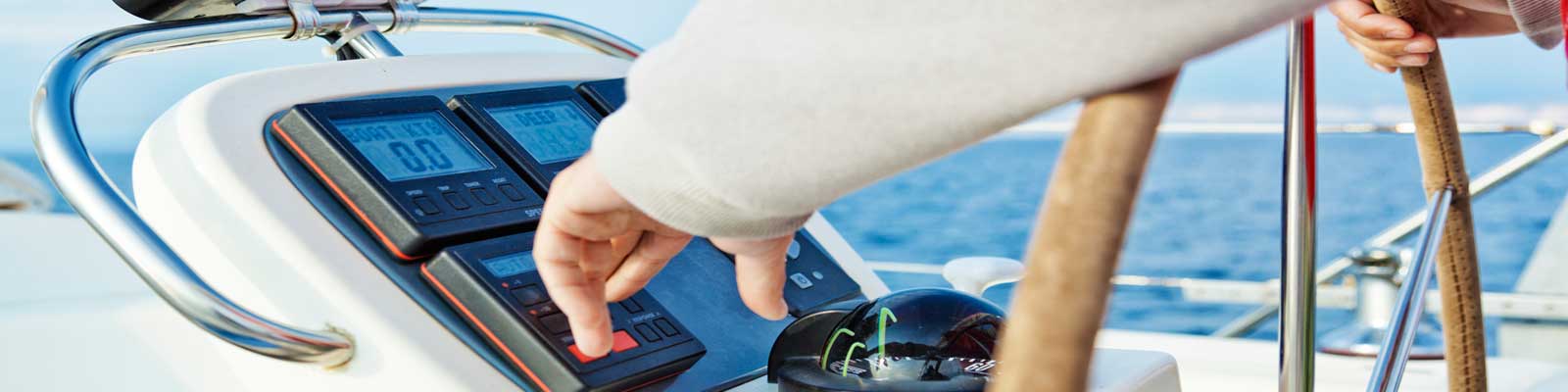
Good navigation is an active task, not a passive one. Just looking down at a chart display to make sure that the boat’s icon is sitting on the course line to the next waypoint is a passive technique. Constantly checking where the boat is and comparing it to the boat’s icon on the electronic chart display to confirm the correct position is an active technique.
When in sight of land, coastal navigation methods such as using a hand-bearing compass to take a three-point fix, plotting danger bearings, and lining up natural ranges to make you’re your boat is on course are all navigational tools of the trade. Far out at sea, boaters have been using a sextant to measure the altitudes of the sun, moon, stars and planets to obtain a three-point fix for hundreds of years.
Smart navigation begins with voyage planning, no matter how short or long your planned trip. The navigator must appraise, plan, execute and monitor every journey. Appraisal includes having all the charts, cruising guides, tide tables and electronic tools (radar, GPS, chart plotter) necessary. Planning includes plotting the
intended route and becoming aware of all possible hazards along the way. Execution means leaving the dock and following the voyage plan. Monitoring means taking the written passage plan and, once underway, adjusting it for changes in the weather, mechanical breakdowns or crew illnesses.
In 1996, the Navy decided it would no longer teach celestial navigation to the midshipmen at the Naval Academy. Why? Because by 1995, the constellation of Global Positioning System satellites launched by the Department of Defense was working well enough to give mariners GPS positions that were accurate within tens of feet anywhere on Earth. Since then, GPS has become ubiquitous — on our boats, in our cars, and in our smart phones.
But in late 2015 the Navy reversed itself, and middies are once again being taught celestial navigation at Annapolis. Why? Because the threat of cyberattacks is real, the GPS system has the potential to be hacked, and during wartime satellites can be destroyed. The Navy also understands that if power is lost aboard a ship, the computers and all on-board electronic navigation systems will go dark. It is critical to know what to do aboard your boat in the event of a power loss to all electronic navigational equipment.
As boaters, the journey to our destination should be just as important as what we do when we get there. Learning how to use the complete toolkit of available navigation techniques and honing those skills by continued practice helps assure a safe journey. It also directly connects us to mariners of the past, who used many of those same methods to sail across oceans and explore new worlds.
Capt. Jeff Werner has been in the yachting industry for over 25 years. In addition to working as a captain on private and charter yachts, both sail and power, he is a certified instructor for the USCG, US Sailing, RYA and the MCA. He is also the Diesel Doctor, helping to keep your yacht’s fuel in optimal condition for peak performance. For more information, call 239-246-6810, or visit MyDieselDoctor.com. All Marinalife members receive a 10% discount on purchases of equipment, products and supplies from Diesel Doctor.